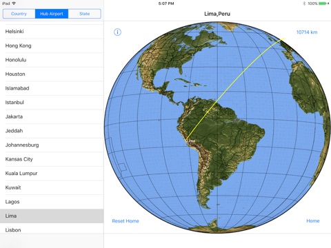
THEREGO displays “great circle” routes between locations on the global earth. It is the digital equivalent of stretching a string on a model globe of the earth from a nearby city to a distant city on the other side of the globe. As such, THEREGO gives you the power to instantly visualize where a distant city or country lies relative to a city near you, how far away it is, and what parts of the globe are passed along the route. You can’t do that with the typical “flattened earth” Mercator projection classroom map.
THEREGO automatically presents appropriate views of the global earth on which is displayed the great circle route from a starting location on the near side of the earth to a destination on the far side. Distance along the great circle route is displayed in a choice of either stature miles or kilometers. Locations for the home point and destination of interest are chosen from a table of lists that includes the capitals of all nations and those of the U.S. States and Canadian provinces, plus major hub airport locations around the world.
THEREGO is a great way to locate cities and counties in the news and advance one’s understanding of global geography, or perhaps just to contemplate where to go next on your global travels.
THEREGO is currently available only for iPad using iOS 9 and later.


